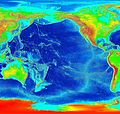
Abruozdielis:Pacific elevation.jpg

Parvaizos dėdloms: 632 × 599 pikselē. Kėtū dėdlomu: 253 × 240 pikselē | 506 × 480 pikselē | 810 × 768 pikselē | 1 080 × 1 024 pikselē | 2 500 × 2 370 pikselē.
Pradėnis abruozdielis ((2 500 × 2 370 taškū, faila dėdoms: 899 KiB, MIME tips: image/jpeg))
Abruozdielė istuorėjė
Paspauskėt ont deinas/čiesa, ka paveizietomėt abruozdieli, kāp ons ėšruodė pradiuo.
| Dėina/Čiesos | Pamažėnėms | Mierā | Nauduotuos | Paāškėnėms | |
|---|---|---|---|---|---|
| vielībs | 06:41, 7 kuova 2006 |  | 2 500 × 2 370 (899 KiB) | Interiot~commonswiki | Elevation of the Pacific ocean Source: http://www.ngdc.noaa.gov/mgg/image/2minrelief.html |
Abruozdieliu nauduojėms
Ons poslapis ruod ton abruozdielin:
Abruozdielė nauduojėms vėsor
Tėi viki poslapē nauduo šėton abruozdieli:
- Skvarmas nauduojėms als.wikipedia.org
- Skvarmas nauduojėms ang.wikipedia.org
- Skvarmas nauduojėms ar.wikipedia.org
- Skvarmas nauduojėms avk.wikipedia.org
- Skvarmas nauduojėms azb.wikipedia.org
- Skvarmas nauduojėms az.wikipedia.org
- Skvarmas nauduojėms be.wikipedia.org
- Skvarmas nauduojėms bg.wikipedia.org
- Skvarmas nauduojėms bn.wikipedia.org
- Skvarmas nauduojėms bs.wikipedia.org
- Skvarmas nauduojėms ca.wikipedia.org
- Skvarmas nauduojėms ceb.wikipedia.org
- Skvarmas nauduojėms chr.wikipedia.org
- Skvarmas nauduojėms crh.wikipedia.org
- Skvarmas nauduojėms cs.wikipedia.org
- Skvarmas nauduojėms da.wikipedia.org
- Skvarmas nauduojėms de.wikipedia.org
- Skvarmas nauduojėms de.wiktionary.org
- Skvarmas nauduojėms dsb.wikipedia.org
- Skvarmas nauduojėms en.wikipedia.org
- Skvarmas nauduojėms en.wikibooks.org
- Skvarmas nauduojėms es.wikipedia.org
- Skvarmas nauduojėms et.wikipedia.org
- Skvarmas nauduojėms ext.wikipedia.org
- Skvarmas nauduojėms fa.wikipedia.org
- Skvarmas nauduojėms fiu-vro.wikipedia.org
- Skvarmas nauduojėms fi.wikipedia.org
- Skvarmas nauduojėms fj.wikipedia.org
- Skvarmas nauduojėms frr.wikipedia.org
- Skvarmas nauduojėms fy.wikipedia.org
- Skvarmas nauduojėms gan.wikipedia.org
- Skvarmas nauduojėms gd.wikipedia.org
- Skvarmas nauduojėms gl.wikipedia.org
- Skvarmas nauduojėms he.wikipedia.org
- Skvarmas nauduojėms hif.wikipedia.org
- Skvarmas nauduojėms hr.wikipedia.org
- Skvarmas nauduojėms hsb.wikipedia.org
- Skvarmas nauduojėms hu.wikipedia.org
Veizietė, kāp vėsor tasā abruozdielis nauduojams īr.

