Abruozdielis:Earth Western Hemisphere.jpg
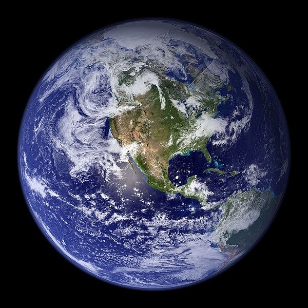
Parvaizos dėdloms: 600 × 600 pikselē. Kėtū dėdlomu: 240 × 240 pikselē | 480 × 480 pikselē | 768 × 768 pikselē | 1 024 × 1 024 pikselē | 2 048 × 2 048 pikselē.
Pradėnis abruozdielis ((2 048 × 2 048 taškū, faila dėdoms: 579 KiB, MIME tips: image/jpeg))
Abruozdielė istuorėjė
Paspauskėt ont deinas/čiesa, ka paveizietomėt abruozdieli, kāp ons ėšruodė pradiuo.
| Dėina/Čiesos | Pamažėnėms | Mierā | Nauduotuos | Paāškėnėms | |
|---|---|---|---|---|---|
| vielībs | 06:09, 25 rogpjūtė 2005 | 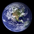 | 2 048 × 2 048 (579 KiB) | Tom | {{PD-USGov-NASA}} http://earthobservatory.nasa.gov/Newsroom/BlueMarble/Images/globe_west_2048.jpg Much of the information contained in this image came from a single remote-sensing device-NASA’s Moderate Resolution Imaging Spectroradiometer, or MODIS. |
Abruozdieliu nauduojėms
Abruozdielėp neruod anėjuoks poslapis.
Abruozdielė nauduojėms vėsor
Tėi viki poslapē nauduo šėton abruozdieli:
- Skvarmas nauduojėms af.wikipedia.org
- Skvarmas nauduojėms ang.wikipedia.org
- Skvarmas nauduojėms ar.wikipedia.org
- العالم
- الأرض
- آسيا
- قارة
- المحيط الهندي
- المحيط الهادئ
- القارة القطبية الجنوبية
- أمريكا الشمالية
- أمريكا الجنوبية
- علم البيئة
- نظام بيئي
- المحيط المتجمد الشمالي
- علوم الأرض
- المحيط الجنوبي
- الصفائح التكتونية
- طبيعة
- محيط (جغرافيا)
- تاريخ الأرض
- حيوم
- أستراليا (قارة)
- تغير أسماء دول آسيا خلال القرن العشرين
- برية
- إفريقيا
- المحيط الأطلسي
- بوابة:المجموعة الشمسية
- تاريخ الأرض الجيولوجي
- العالم من دوننا (كتاب)
- بنية الأرض
- قالب:الأرض الطبيعية
- مستقبل الأرض
- اختلال بيئي
- أرض صلبة
- مركز مراقبة علوم وموارد الأرض
- بوابة:المجموعة الشمسية/قوالب
- تاريخ آسيا الوسطى
- بيئة طبيعية
- مستخدم:Nehaoua/مهامي
- دائرة قطبية
- تضاريس قارة إفريقيا
- الفريق المعني برصد الأرض
- بوابة:محيطات
- بوابة:محيطات/قوالب
- Skvarmas nauduojėms arz.wikipedia.org
- Skvarmas nauduojėms ast.wikipedia.org
- Skvarmas nauduojėms bg.wikipedia.org
Veizietė, kāp vėsor tasā abruozdielis nauduojams īr.


