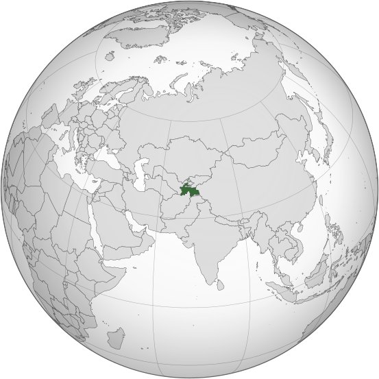
Abruozdielis:Tajikistan (orthographic projection).svg

Rinkmenos SVG peržiūros PNG dydisː 553 × 553 pikselē. Kėtū dėdlomu: 240 × 240 pikselē | 480 × 480 pikselē | 768 × 768 pikselē | 1 024 × 1 024 pikselē | 2 048 × 2 048 pikselē.
Pradėnis abruozdielis (SVG skvarmou, fuormalē 553 × 553 puškiu, skvarmenė dėdloms: 304 KiB)
Abruozdielė istuorėjė
Paspauskėt ont deinas/čiesa, ka paveizietomėt abruozdieli, kāp ons ėšruodė pradiuo.
| Dėina/Čiesos | Pamažėnėms | Mierā | Nauduotuos | Paāškėnėms | |
|---|---|---|---|---|---|
| vielībs | 02:41, 17 kuova 2015 |  | 553 × 553 (304 KiB) | Flappiefh | Removed Somaliland and Kosovo. Separated Western Sahara and Morroco. |
| 19:39, 4 rogpjūtė 2013 |  | 553 × 553 (308 KiB) | Flappiefh | Added South Sudan. The map is now centered on Tadjikistan. | |
| 12:21, 16 gegožė 2011 |  | 550 × 550 (485 KiB) | Eddo | graphic design? | |
| 19:24, 23 sausė 2011 |  | 107 × 107 (79 KiB) | RaviC | {{Information |Description={{en|Location of Tajikistan. Taken from [http://www.un.org/Depts/Cartographic/map/profile/tajikist.pdf UN Map]<br/> en:Category:Maps of Tajikistan}} |Source=Transferred from [http://en.wikipedia.org en.wikipedia]; transf |
Abruozdieliu nauduojėms
Ons poslapis ruod ton abruozdielin:
Abruozdielė nauduojėms vėsor
Tėi viki poslapē nauduo šėton abruozdieli:
- Skvarmas nauduojėms ace.wikipedia.org
- Skvarmas nauduojėms ady.wikipedia.org
- Skvarmas nauduojėms af.wikipedia.org
- Skvarmas nauduojėms als.wikipedia.org
- Skvarmas nauduojėms ami.wikipedia.org
- Skvarmas nauduojėms ar.wikipedia.org
- طاجيكستان
- بوابة:العالم الإسلامي/دولة مختارة/أرشيف
- بوابة:العالم الإسلامي/دولة مختارة/29
- بوابة:طاجيكستان
- بوابة:طاجيكستان/واجهة
- قائمة الدول ذات السيادة والأقاليم التابعة في آسيا
- معاملة المثليين في طاجيكستان
- العلاقات الأمريكية الطاجيكية
- العلاقات الأنغولية الطاجيكستانية
- العلاقات الطاجيكستانية الكورية الجنوبية
- العلاقات الإريترية الطاجيكستانية
- العلاقات السويسرية الطاجيكستانية
- العلاقات الألمانية الطاجيكستانية
- العلاقات الطاجيكستانية الليختنشتانية
- العلاقات البوليفية الطاجيكستانية
- العلاقات الطاجيكستانية الموزمبيقية
- العلاقات الألبانية الطاجيكستانية
- العلاقات البلجيكية الطاجيكستانية
- العلاقات الإثيوبية الطاجيكستانية
- العلاقات البيلاروسية الطاجيكستانية
- العلاقات الروسية الطاجيكية
- العلاقات الرومانية الطاجيكستانية
- العلاقات الأرجنتينية الطاجيكستانية
- العلاقات الطاجيكستانية الغامبية
- العلاقات الطاجيكستانية القبرصية
- العلاقات السيراليونية الطاجيكستانية
- العلاقات الطاجيكستانية النيبالية
- العلاقات الطاجيكستانية الليبيرية
- العلاقات التشيكية الطاجيكستانية
- العلاقات الطاجيكستانية الميانمارية
- العلاقات الطاجيكستانية الكندية
- العلاقات الزيمبابوية الطاجيكستانية
- العلاقات الإسرائيلية الطاجيكستانية
- العلاقات البالاوية الطاجيكستانية
- العلاقات الطاجيكستانية المالية
- العلاقات الطاجيكستانية النيجيرية
- العلاقات اليمنية الطاجيكستانية
- العلاقات الطاجيكستانية الفانواتية
- العلاقات الغابونية الطاجيكستانية
- العلاقات البنمية الطاجيكستانية
- العلاقات الطاجيكستانية الكوبية
- العلاقات الجورجية الطاجيكستانية
- العلاقات التونسية الطاجيكستانية
- العلاقات الطاجيكستانية الكورية الشمالية
- العلاقات الهندية الطاجيكية
Veizietė, kāp vėsor tasā abruozdielis nauduojams īr.

