
Abruozdielis:Whole world - land and oceans 12000.jpg

Parvaizos dėdloms: 800 × 400 pikselē. Kėtū dėdlomu: 320 × 160 pikselē | 640 × 320 pikselē | 1 024 × 512 pikselē | 1 280 × 640 pikselē | 2 560 × 1 280 pikselē | 24 000 × 12 000 pikselē.
Pradėnis abruozdielis ((24 000 × 12 000 taškū, faila dėdoms: 19,11 MiB, MIME tips: image/jpeg))
| Tas abruozdielis īr ėš Vikitėkuos arkīvu. Anuo orėgėnalos aprašėma poslapis īr čiuonās. |
Paāškėnėms
| Warning | The original file is very high-resolution. It might not load properly or could cause your browser to freeze when opened at full size. |
|---|
| Aprašīms |
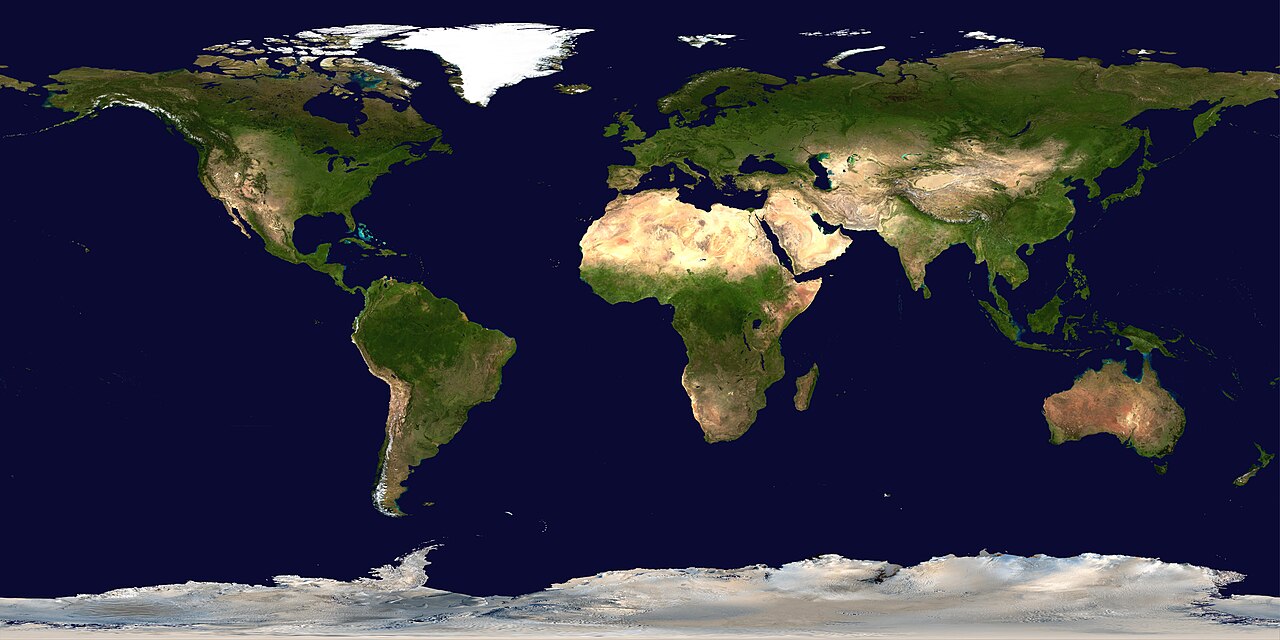
Deutsch: Satellitenbild der Erdoberoberfläche.
English: Satellite composition of the whole Earth's surface.
العربية: صور ساتليَّة مُجمَّعة لتُظهر سطح الأرض كاملًا. |
| Čiesos | image released 11. Feb. 2002 |
| Šaltėnis |
NASA - Visible Earth, images combined and scaled down by HighInBC (20 megabyte upload limit) |
| Kūries | NASA/Goddard Space Flight Center |
| Laidėms (Abruozdielė parnauduojėms) |
Copyright information from http://visibleearth.nasa.gov/useterms.php - With the exception of images produced by the SeaWiFS, QuickBird, and IKONOS instruments all images on the Visible Earth are governed by NASA's Terms of Use below. [...] For all non-private uses, NASA's Terms Of Use are as follows: 1. The imagery is free of licensing fees 2. NASA requires that they be provided a credit as the owners of the imagery [...] |
| Kitos versijos |
|


|

Lėcencėjė
| Šis failas licencijuojamas viešajam naudojimui, nes jis buvo sukurtas NASA. NASA autorinių teisių taisyklės nurodo, kad „NASA medžiaga nėra saugoma autorinių teisių, išskyrus pažymėtą“ (NASA autorių teisių taisylės arba JPL paveikslėlių naudojimo tvarka). | ||
 |
Įspėjimai:
|
Abruozdielė istuorėjė
Paspauskėt ont deinas/čiesa, ka paveizietomėt abruozdieli, kāp ons ėšruodė pradiuo.
| Dėina/Čiesos | Pamažėnėms | Mierā | Nauduotuos | Paāškėnėms | |
|---|---|---|---|---|---|
| vielībs | 22:58, 14 rogpjūtė 2006 | | 24 000 × 12 000 (19,11 MiB) | HInBC | {{Information| |Description = Satellite composition of the whole Earth's surface. |Source = NASA - Visible Earth, images combined and scaled down by HighInBC (20 megabyte upload limit) * [http://visibleearth.nasa.gov/view_rec.php?vev1id= |
Abruozdieliu nauduojėms
Abruozdielėp neruod anėjuoks poslapis.
Abruozdielė nauduojėms vėsor
Tėi viki poslapē nauduo šėton abruozdieli:
- Skvarmas nauduojėms als.wikipedia.org
- Skvarmas nauduojėms arc.wikipedia.org
- Skvarmas nauduojėms ar.wikipedia.org
- مستخدم:ديفيد/صور ساهمت في جعلها مختارة
- ويكيبيديا:ترشيحات الصور المختارة/صورة لقارات العالم بالقمر الصناعي
- ويكيبيديا:صورة اليوم المختارة/يوليو 2015
- قالب:صورة اليوم المختارة/2015-07-26
- ويكيبيديا:صورة اليوم المختارة/أكتوبر 2016
- قالب:صورة اليوم المختارة/2016-10-03
- ويكيبيديا:صورة اليوم المختارة/يوليو 2018
- قالب:صورة اليوم المختارة/2018-07-22
- ويكيبيديا:صورة اليوم المختارة/سبتمبر 2022
- قالب:صورة اليوم المختارة/2022-09-10
- ويكيبيديا:ترشيحات الصور المختارة/سحب/الرخام الأزرق
- Skvarmas nauduojėms arz.wikipedia.org
- Skvarmas nauduojėms ast.wikipedia.org
- Skvarmas nauduojėms bg.wikipedia.org
- Skvarmas nauduojėms bi.wikipedia.org
- Skvarmas nauduojėms bpy.wikipedia.org
- Skvarmas nauduojėms br.wikipedia.org
- Skvarmas nauduojėms ca.wikipedia.org
- Skvarmas nauduojėms ca.wikibooks.org
- Skvarmas nauduojėms ceb.wikipedia.org
- Skvarmas nauduojėms co.wikipedia.org
- Skvarmas nauduojėms cs.wikipedia.org
- Skvarmas nauduojėms de.wikipedia.org
- Skvarmas nauduojėms de.wikinews.org
- Skvarmas nauduojėms de.wiktionary.org
Veizietė, kāp vėsor tasā abruozdielis nauduojams īr.